

Sequoia and Kings Canyon National Park Recreation Map
This app brings the Sequoia and Kings
Canyon National Parks Recreation Map
from Tom Harrison Maps to the iPhone
and iPod touch.
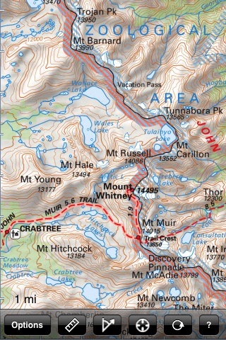
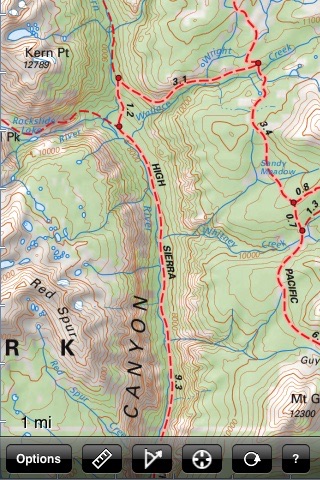
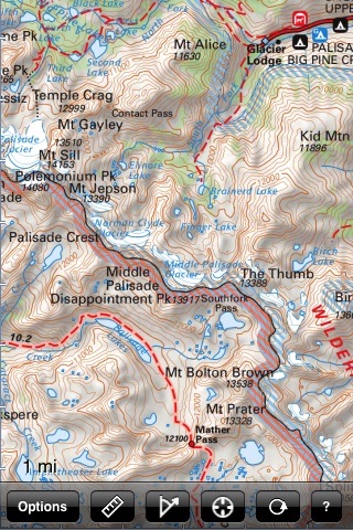
The map covers Kern Canyon, Kings Canyon,
the Sierra crest from Mount Langley
and Mount Whitney to the Palisades,
Courtright Reservoir, Mineral King, and
other areas in Sequoia and Kings Canyon
National Parks. The map shows trails,
backcountry roads, highways, towns, water
features, peaks, canyons, campgrounds, and ranger stations, all on a shaded relief topo map with 200-foot contours. This map is perfect for hiking, backpacking, mountaineering, geocaching, backcountry 4x4 touring, or just checking out this stunning
region from the pavement.
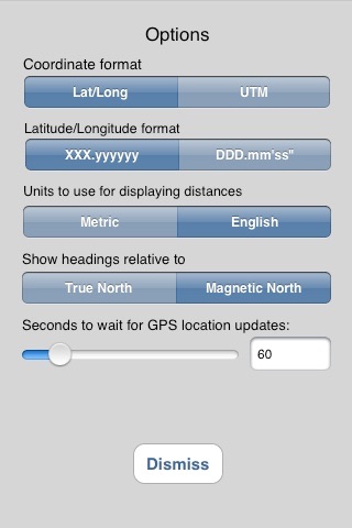
Navigate the map using standard touch
gestures to zoom and drag. Mark your
location, measure distances, orient
yourself by taking bearings to landmarks,
and use your iPhones GPS to find your
location on the map. Add your own markers
to the map, and export them via email for
display in Google Earth or other
applications.